Ads

About WorldMonitor APP
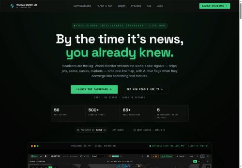
world monitor is a real-time global intelligence dashboard that streams live signals and overlays them on an interactive map.Aggregates 500+ curated feeds and 65+ data providers, including AIS vessel tracking, satellite positions, flight data, BGP anomaly feeds, and sensor alerts.
Signal fusion and a correlation engine link geopolitical events, maritime chokepoints, infrastructure outages, and weather to market and commodity price movements.Provides country risk scores, instability indices, independent alert origins, and time-series dossiers to support analysts, traders, risk managers, and supply-chain operators.
Maps subsea cables, pipelines, ports, AI datacenters and power infrastructure to reveal transmission paths and supply-chain exposure.Market panels display FX, equities, crypto, energy and commodity indicators alongside physical-flow signals to surface regime shifts and repricing.
Keyboard shortcuts, customizable lenses, and alerting enable rapid navigation, focused monitoring, and operational response.
Key Features
Use Cases
Who is it for?
Signal fusion and a correlation engine link geopolitical events, maritime chokepoints, infrastructure outages, and weather to market and commodity price movements.Provides country risk scores, instability indices, independent alert origins, and time-series dossiers to support analysts, traders, risk managers, and supply-chain operators.
Maps subsea cables, pipelines, ports, AI datacenters and power infrastructure to reveal transmission paths and supply-chain exposure.Market panels display FX, equities, crypto, energy and commodity indicators alongside physical-flow signals to surface regime shifts and repricing.
Keyboard shortcuts, customizable lenses, and alerting enable rapid navigation, focused monitoring, and operational response.
Key Features
- Real-time global dashboard that streams live signals and overlays them on an interactive map
- Aggregates multi-source data from curated feeds and providers, including AIS vessel tracking, satellite positions, flight data, BGP anomaly feeds, and sensor alerts
- Signal fusion and correlation engine that links geopolitical events, maritime chokepoints, infrastructure outages, and weather to market and commodity signals
- Maps infrastructure (subsea cables, pipelines, ports, AI datacenters, power infrastructure) to visualize transmission paths and supply-chain topology
- Integrated market panels displaying FX, equities, crypto, energy and commodity indicators alongside physical-flow signals, plus keyboard shortcuts, customizable lenses, and alerting
Use Cases
- Monitor global commodity flows by overlaying maritime vessel tracking, satellite imagery, flight data and weather disruptions on the interactive map to anticipate supply shortages, correlate with market indicators and execute faster, data-driven trading decisions
- Map supply-chain exposure end-to-end by aggregating 500+ curated feeds and 65+ data providers into infrastructure and route risk layers, receive real-time geopolitical and weather alerts to reroute shipments, prioritize carrier selection and reduce downtime
- Perform rapid infrastructure and geopolitical risk assessments using the real-time intelligence dashboard to correlate signals from maritime, satellite, flight and market data, generate automated alerts and exportable reports for risk teams, compliance and contingency planning
Who is it for?
- Geopolitical analysts
- Market traders
- Risk managers
- Supply chain operators
- Cybersecurity analysts
No review yet!
More Spatial Analytics AI Tools
Explore other spatial analytics tools with user ratings, pricing details, and in-depth descriptions. Updated regularly by our editorial team.